Alkali Creek Reservoir Design and Permitting
In partnership with the Wyoming Water Development Commission (WWDC), Trihydro is leading the design and permitting of the 9,000 acre-foot Alkali Creek Reservoir in the Nowood River Watershed near Hyattville, Wyoming.
Landowners in the Nowood River Watershed first approached the Wyoming Water Development Office with concerns regarding late-season water shortages and associated watershed impacts. A Level I Storage and Watershed Study supported assertions that hydrologic timing caused late-season water shortages in the watershed while making water available for storage during spring runoff.
The landowners formed the Nowood Watershed Improvement District (NWID) and requested a Level II, Phase I Study to evaluate watershed water demands, assess the location, magnitude, and timing of water availability and shortages, and identify potential storage sites. Trihydro performed the Level II, Phase I feasibility study and conceptual engineering analysis of potential reservoir storage opportunities within the watershed. The studies provided the technical basis for establishing the purpose and need for developing reservoir storage.
Evaluating Potential Storage Sites
Trihydro and its partners developed a StateMOD watershed hydrologic model to determine the most viable storage sites in the watershed. The Level I Study identified 35 potential storage sites. During Level II, Phase I work, Trihydro identified 5 additional sites and evaluated each to determine which might provide the most benefit with the least negative impact. After evaluating the 40 potential storage sites, two reservoir sites moved forward for more in-depth evaluation, which included an enlargement to an existing dam and a new reservoir on Alkali Creek, a small tributary to Paint Rock Creek, which is a primary tributary to the lower Nowood River.
Environmental Permitting
The Alkali Creek reservoir site involves Waters of the US and, therefore, requires a Bureau of Land Management-issued right-of-way permit and an individual US Army Corps of Engineers (USACE) Section 404 Clean Water Act (CWA) permit. Trihydro submitted a right-of-way application to the BLM on behalf of the WWDC, which triggered the BLM’s National Environmental Policy Act (NEPA) process. Trihydro supported the WWDO during the NEPA process by providing the following services:
- Updating the reservoir and ancillary facilities’ conceptual design
- Coordinating and completing surveys to address data gaps
- Supporting public and cooperating agency meetings
- Responding to technical questions from the BLM and the NEPA team
- Preparing a reservoir and road plan of development
- Performing wetland and aquatic resources, cultural and paleontological, bat, and Ute Ladies’ Tresses surveys
- Evaluating alternatives to reservoir development
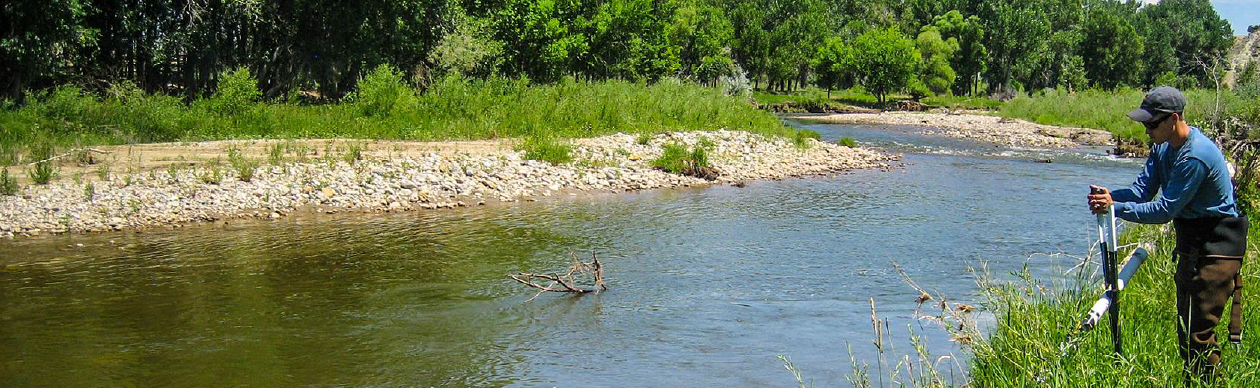
The site received a positive Record of Decision from the BLM. The final Environmental Impact Statement required a water quality Adaptive Management Plan to comply with CWA Section 401 provisions, applicable state surface water quality standards, and total maximum daily loads. The AMP includes a plan to monitor water quality, evaluate impacts on water quality, determine project-related impacts, and identify potential adaptive measures or actions to mitigate water quality impacts. The first steps of plan implementation have included pre-construction monitoring in coordination with the local conservation district.
Trihydro also developed stream and wetland compensatory mitigation plans to satisfy USACE Section 404 CWA permit requirements. The site received a positive Record of Decision from USACE. Additionally, our team supports coordination between WGFD and NWID in developing a Memorandum of Understanding for future reservoir flow operations.
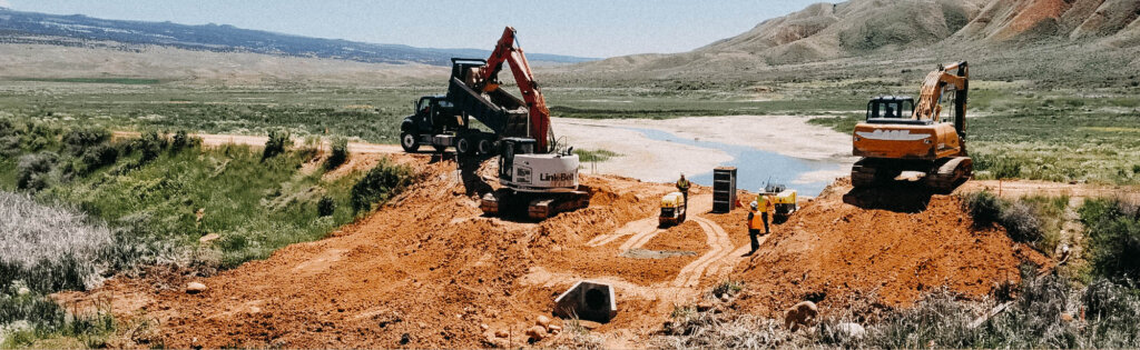
Reservoir Design
Trihydro is developing final designs for the new reservoir, including supply canals, diversions, intake structures, spillways, outlet works, control buildings, public facilities, downstream enhancements, and delivery systems. To further support reservoir development, Trihydro conducted additional investigations and designs to assess site foundation conditions and suitable embankment construction borrow materials and associated hazards.
During the design process, Trihydro conducted topographic surveys using aerial LiDAR and unmanned aerial systems photogrammetry along the existing and proposed dam site, spillways, and irrigation ditches. Trihydro also surveyed structures such as bridges, culverts, irrigation infrastructure, and diversions to assist in the final design. Trihydro also completed legal boundary surveys to support the Record of Survey, the establishment of rights-of-way, easements, and land purchase.
Legal and Construction Permitting
Concurrently with design work, Trihydro and its teaming partners are assisting the NWID in land negotiations to enlarge irrigation ditches and property that would be inundated by the reservoir. Trihydro has also been completing permits required by Big Horn County, the Wyoming Department of Transportation, and the Wyoming State Engineers Office to prepare for construction.
Construction is scheduled to begin in the next few years. Following construction, NWID will operate and maintain the reservoir.